Checking a live camera before you cross the Folly River bridge can spare you a wasted trip. Between commercial surf cams, a hotel cam that pans the front beach and research cameras that track the shoreline, there are plenty of ways to see what the water looks like before you load the car. Here are the feeds worth bookmarking, then head back to the Folly Beach Now guide for the rest of your day.
Surfline Covers the Washout, the Pier and 10th Street
Surfline's Folly Beach page is the go-to for surfers. It has spot pages for the Washout, the Folly Beach Pier and 10th Street, each with a wave-height rating, tide and wind next to the camera view and a multi-day forecast. Free viewing is available, with extra features for subscribers.
The Tides Cam Pans the Front Beach
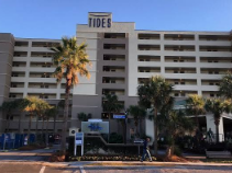
The Tides Folly Beach hotel at 1 Center Street hosts an HD camera run with SurfChex. It cycles through presets starting at the pier and moving west, so you get a view of crowds, weather and surf along the busiest part of the beach. Visit Folly's webcam page streams the same feed alongside local weather.
Research Cameras Track the Shoreline
Folly is also one of the most closely watched beaches on the East Coast. The WebCOOS 6th Avenue camera is part of a NOAA-backed network that uses webcams to study waves, flooding and erosion. Out on the pier, a CoastSnap station lets visitors snap a phone photo from a fixed cradle that adds to a long-term shoreline record kept by the City of Folly Beach.
New cameras are on the way. The city signed a $76,500 contract with Surfline Coastal Intelligence for AI-equipped cameras that measure daily sand gain and loss, document storm damage for aid applications and count beachgoers. As Live 5 News reported, the cameras are low resolution and can't identify faces, and the city is asking Front Beach homeowners between Folly Beach County Park and Summers Place Lane to host them.
Reading a Cam Before You Drive Out
Watch for at least a few minutes rather than judging a single frame — Folly's sets can be several minutes apart. Lines of white water stacking up toward the beach mean a swell is running; a choppy, streaky surface usually means onshore wind. Pair what you see with a surf forecast and the NOAA tide predictions for Charleston, since most Folly breaks shut down at dead low tide. The Washout in particular prefers mid to high tide.
Cams Are Useful Even If You Don't Surf
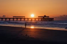
A quick look tells you whether the beach is packed, whether that dark cloud is actually raining on the island, and how busy the pier end of Center Street looks before you go hunting for parking. Before you head out, see what's on the events calendar and pick a spot for after the beach from our dining guide.